

Jefferson Island, a salt dome peninsula breaching the waters of Louisiana's Lake Peigneur, is most widely known as the site of a devastating ecological disaster that took place in 1980. The lake hosted several extractive industries, including a massive salt mine system sitting below the lake's bottom. As salt dome formations typically possess oil deposits at their edges, oil drilling became a common practice in the area as well.
The devastation that resulted from these conditions seems almost inevitable in retrospect. On November 20th, a drill test seeking oil below the lake bottom breached one of the cavernous strips of the salt mine. The 14 inch diameter drill hole funneled the lake's contents to the mines below, forming a massive vortex across the water's surface. Massive barges were swept from their docks and plunged into the water; trees and other debris spun helplessly across the lake. Despite the immediate violence of the event, all miners, rig crew members, and the sole fisherman on the lake each escaped unharmed. Most industries surrounding the lake would close within the decade, and the salt dome now serves as a natural gas storage facility.
Still, the ecological impact of this event would far outweigh its economic consequences. The vortex reversed the flow of the lake's outlet canal, the Delcambre, flooding the emptying lake bed with massive amounts saltwater from the nearby Vermilion Bay. This also created a temporary 160 foot waterfall at the canal's mouth, folding brackish water and unwanted sediment into Peigneur. To this day, the irreversible impact of this event has largely disrupted the original populations of freshwater flora and fauna in the lake. Though some species have adapted or migrated to this newfound ecological condition, most of what once thrived here will never fully recover.
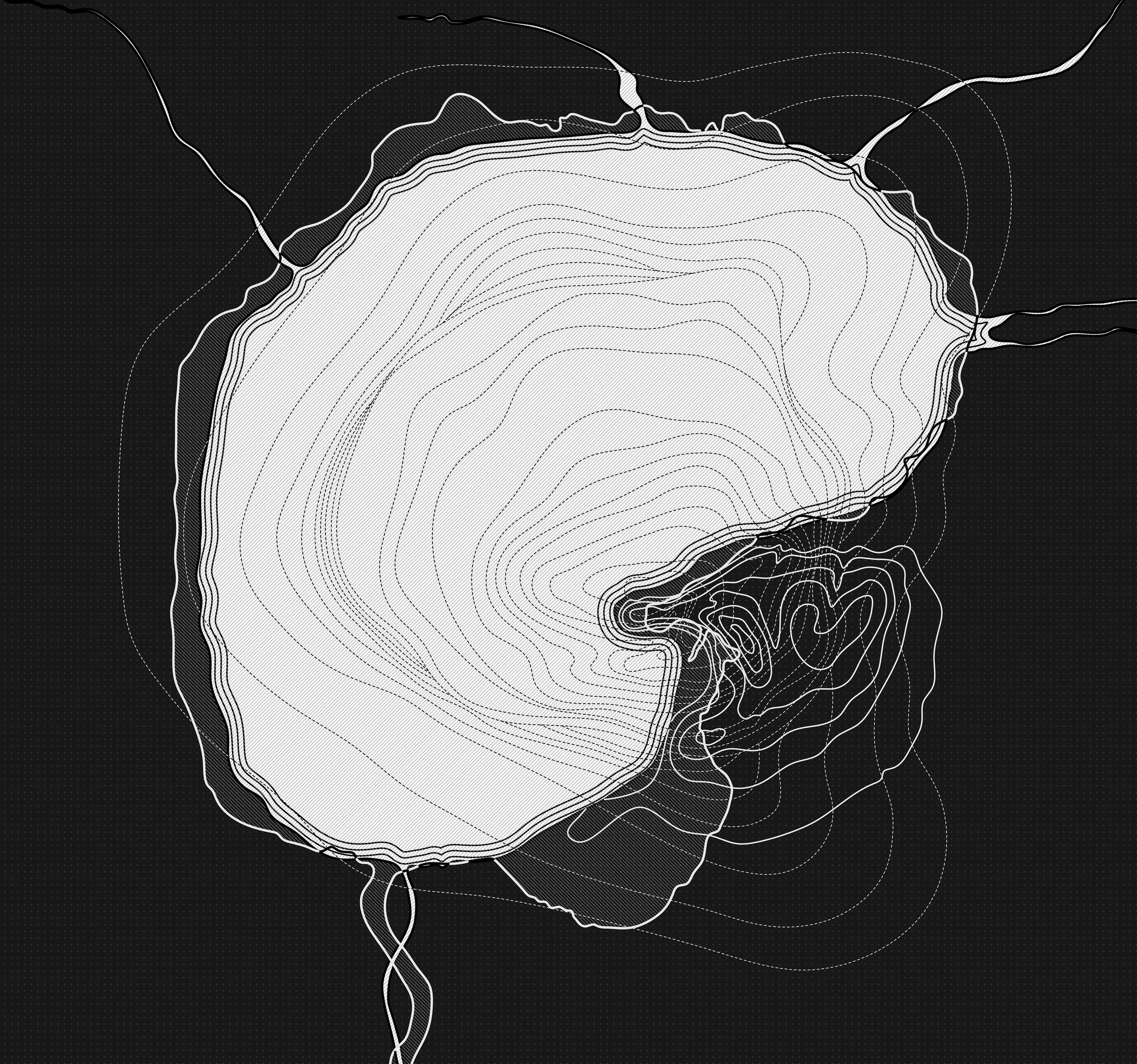
superimposition of topography: salt dome and Jefferson Island
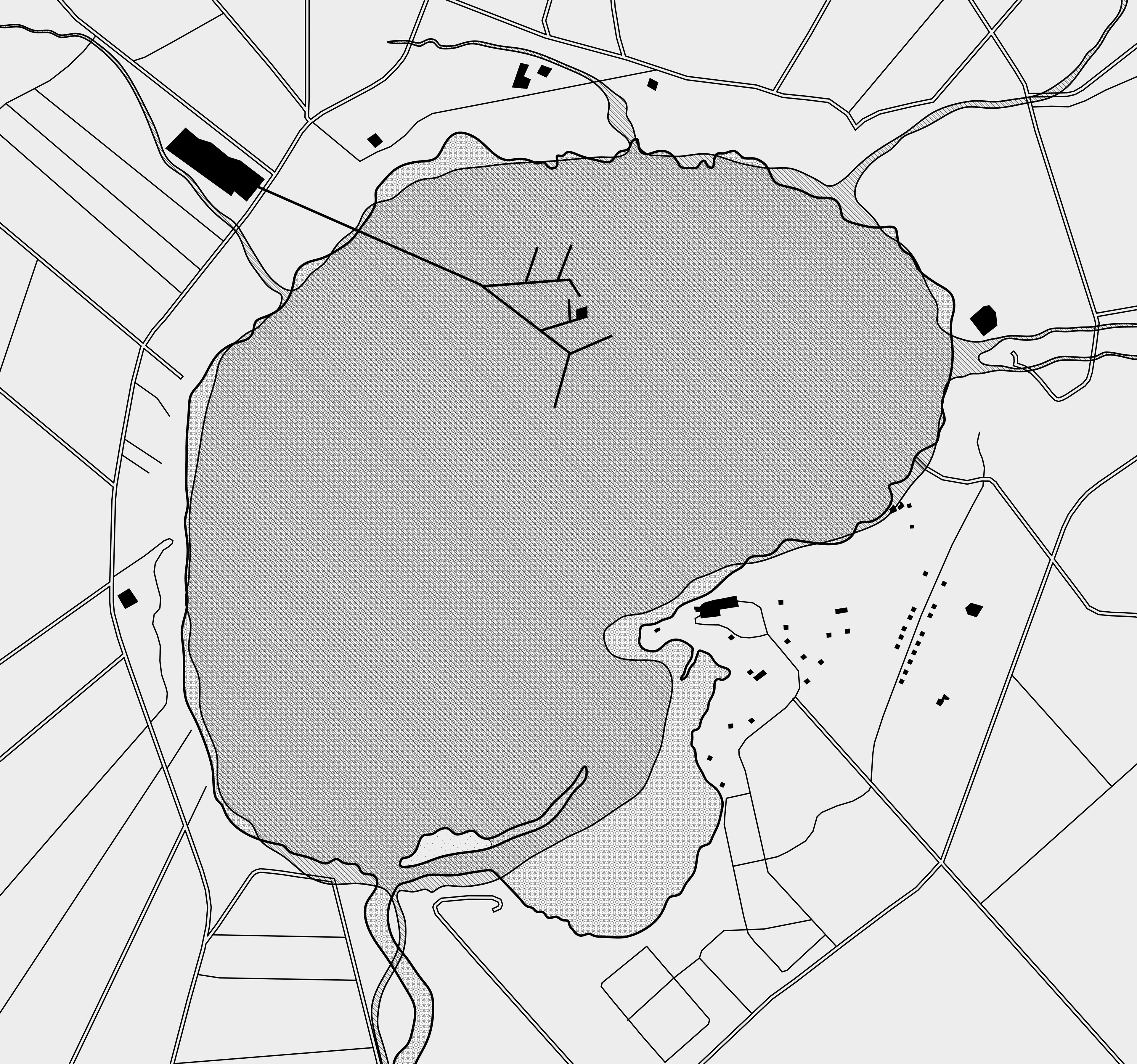
built conditions of Lake Peigneur, 1980
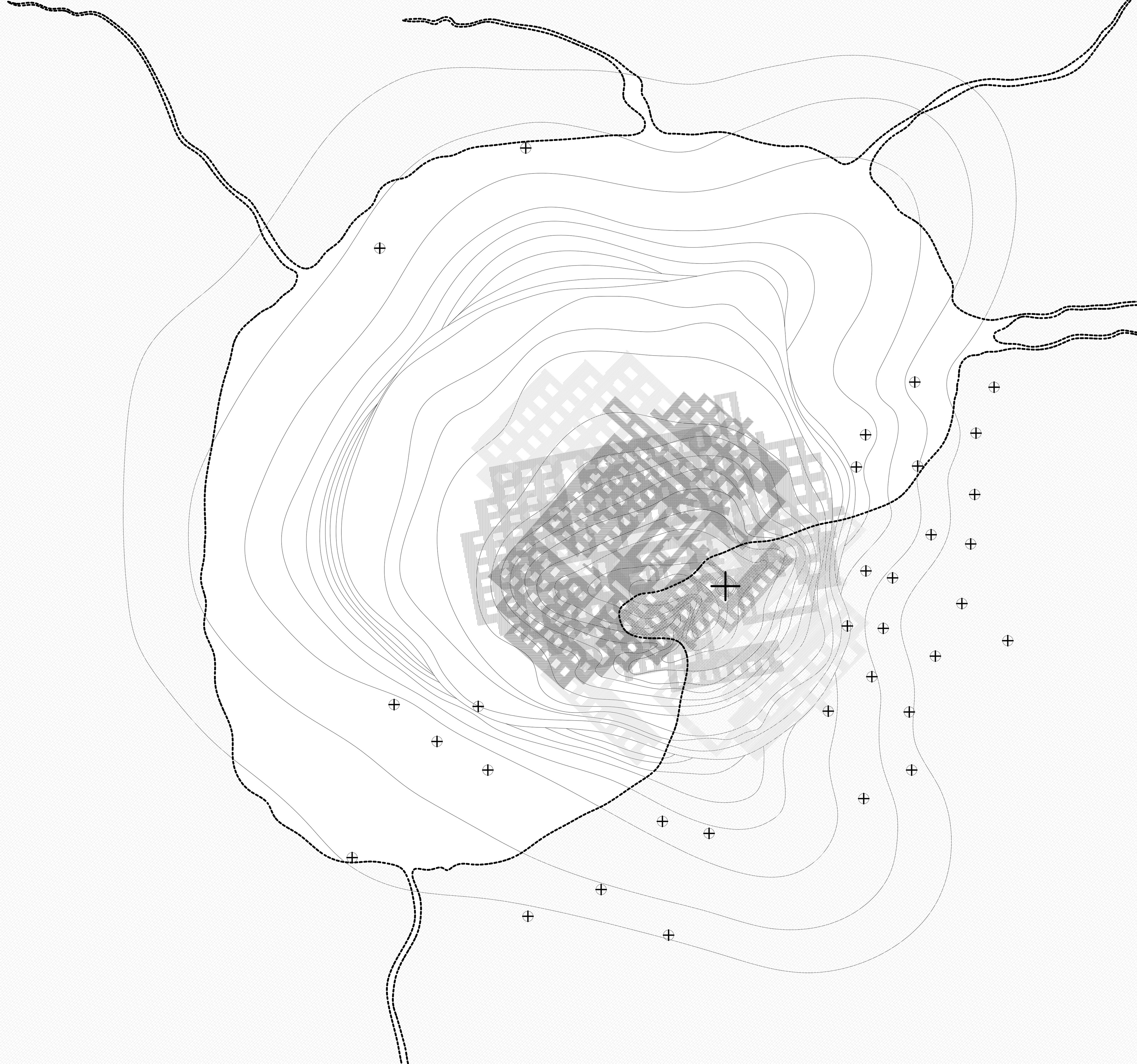
superimposition of industries: overlapping mineshafts and oil drill locations
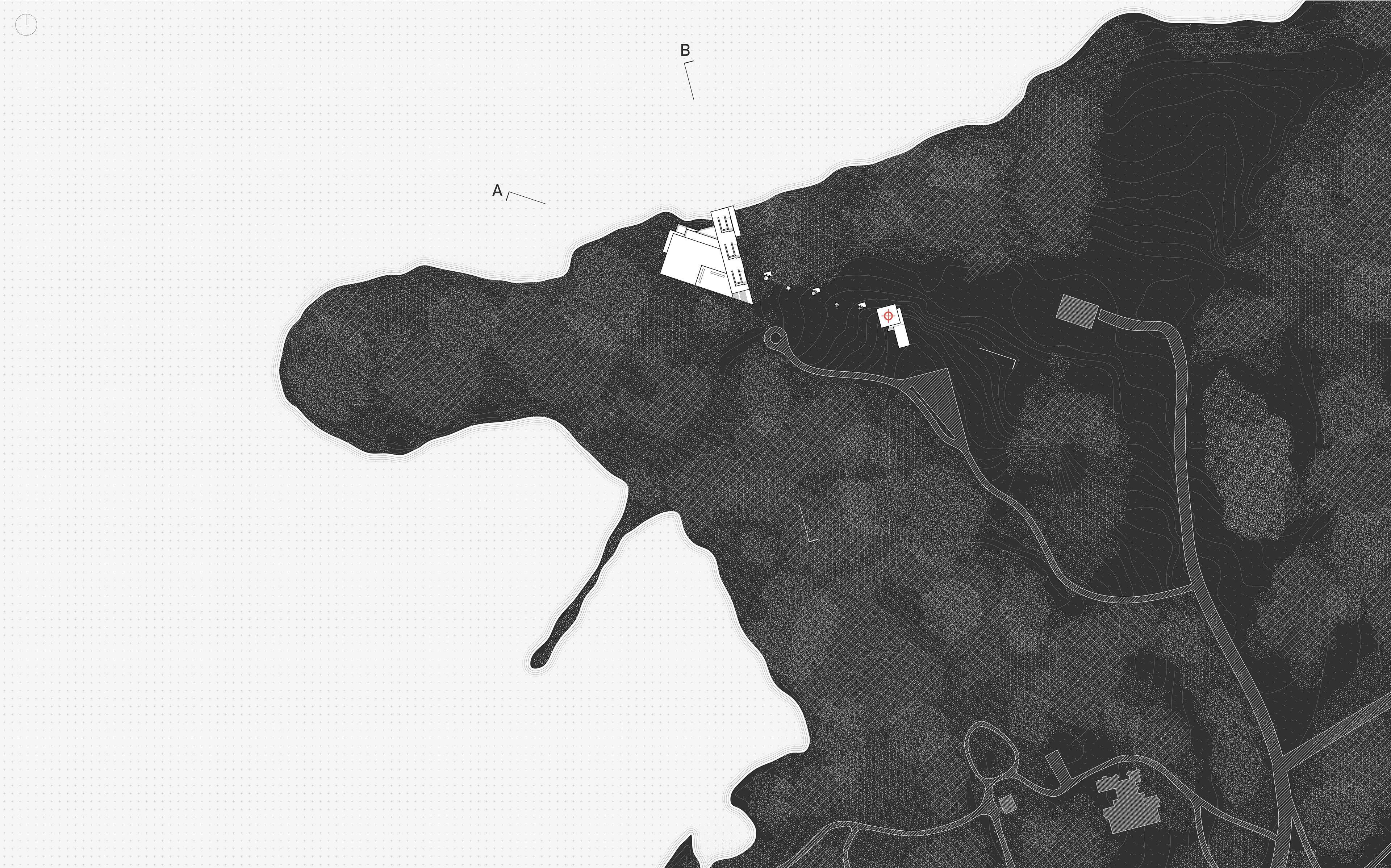
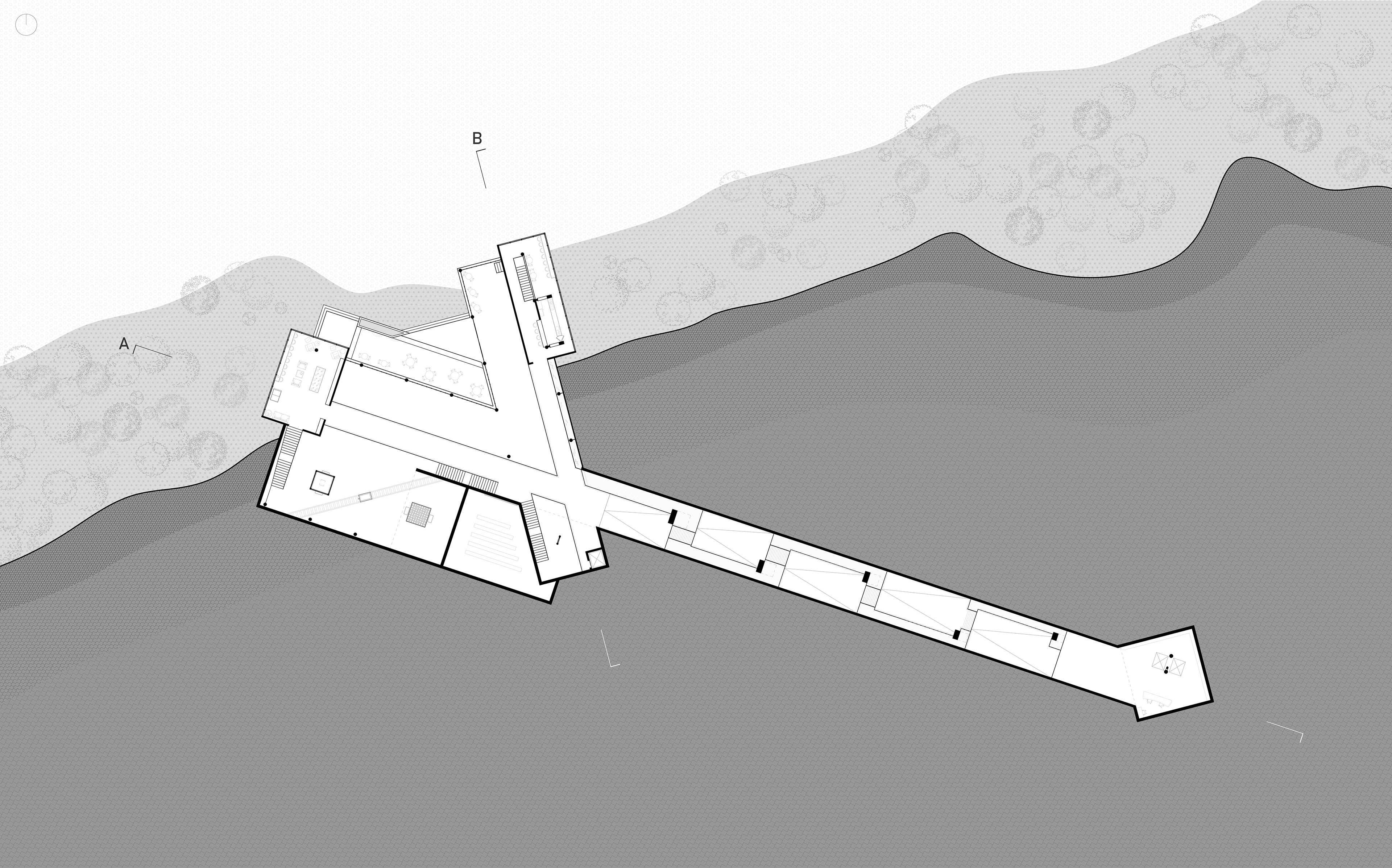
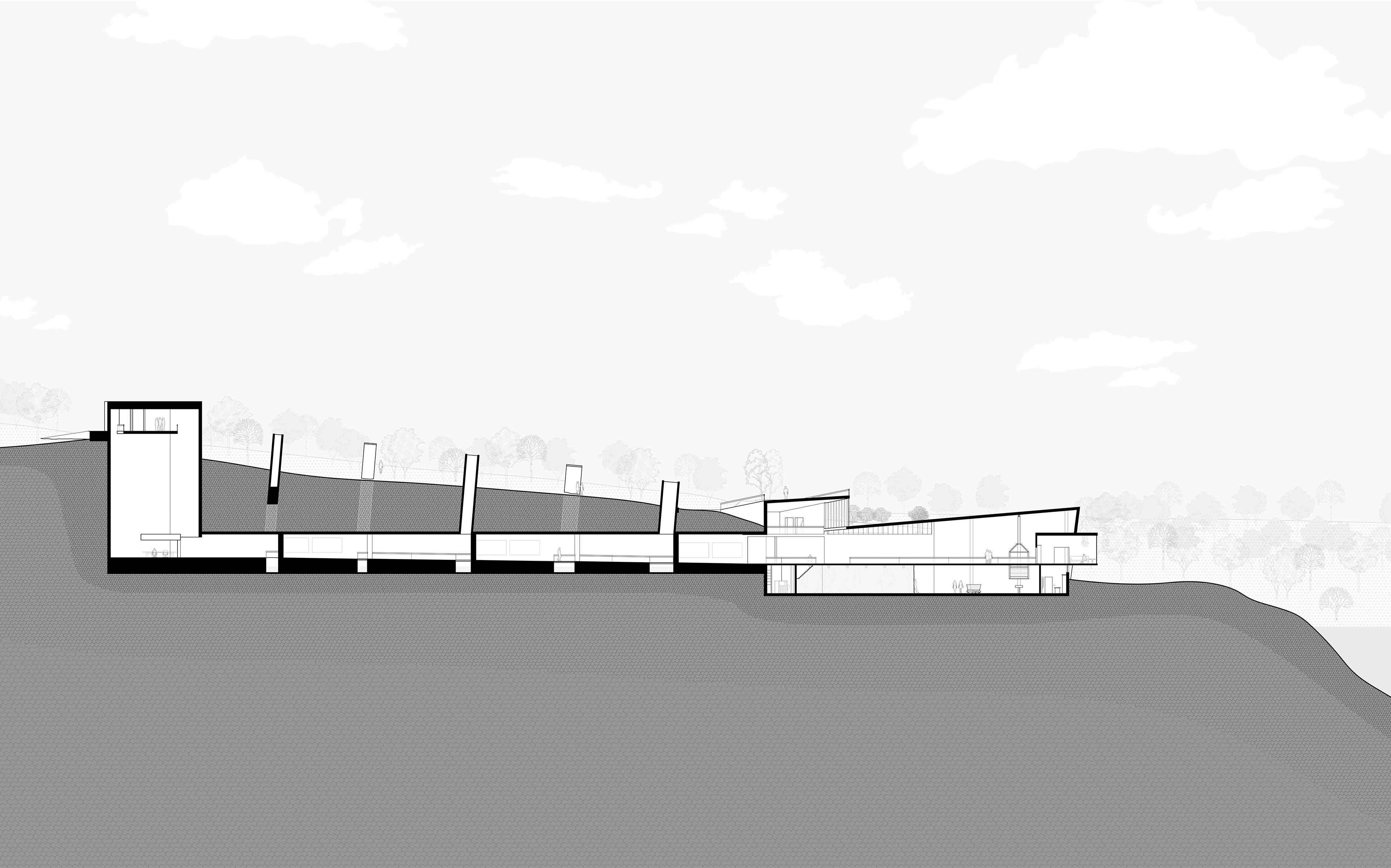
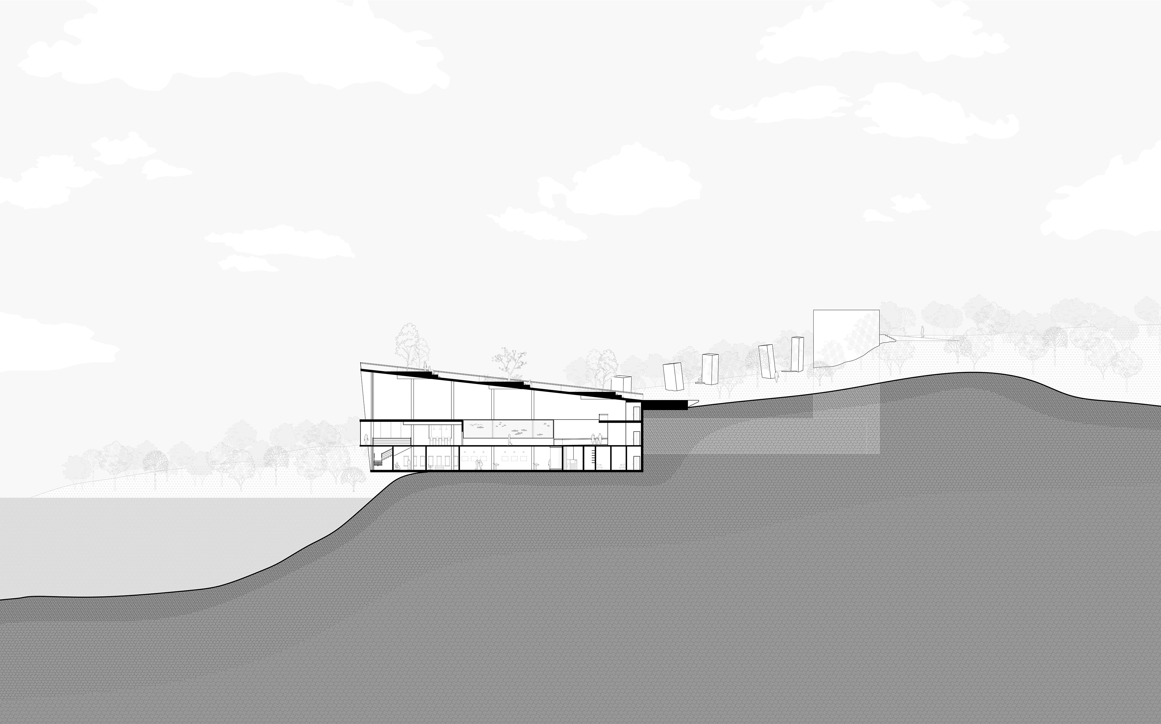
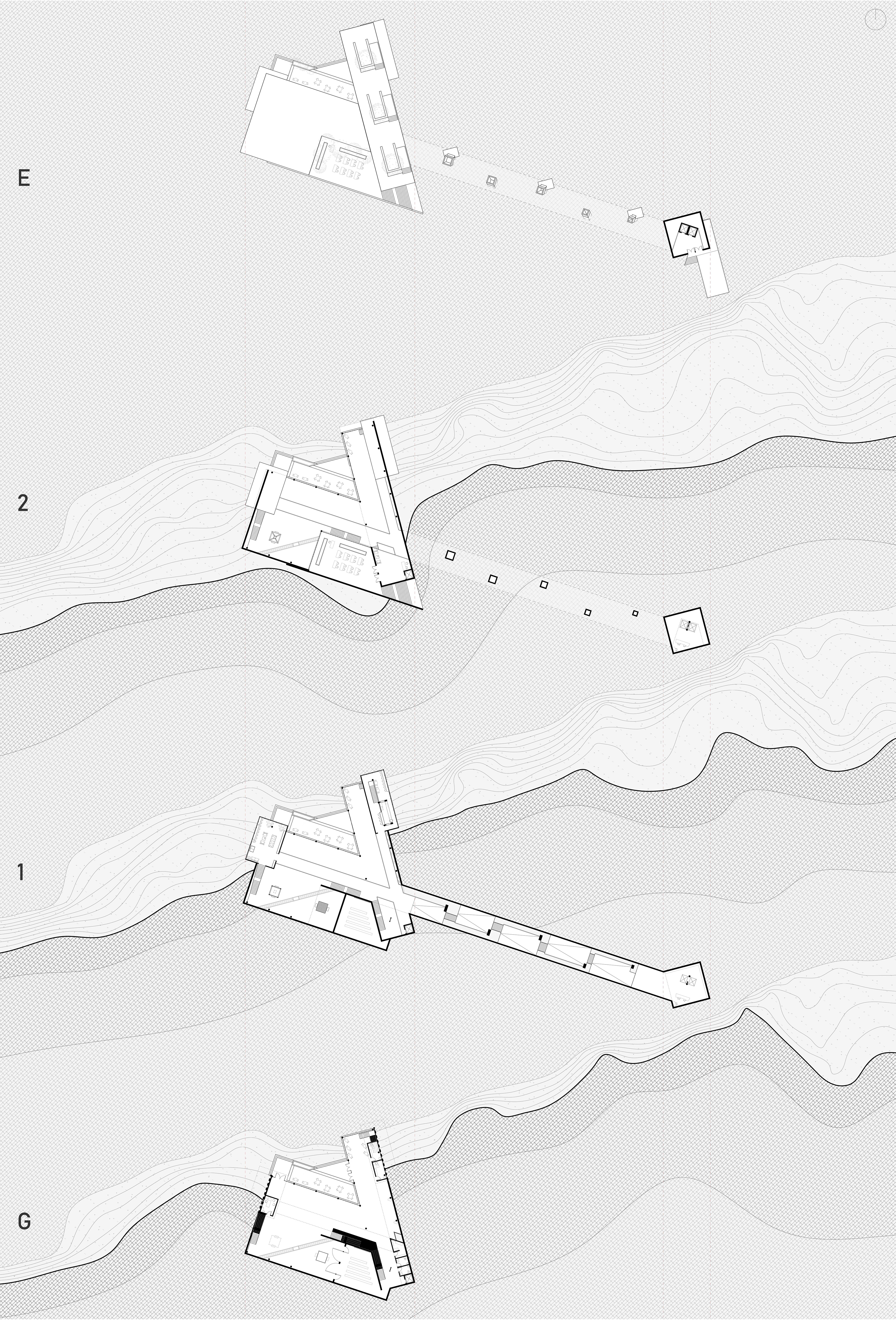
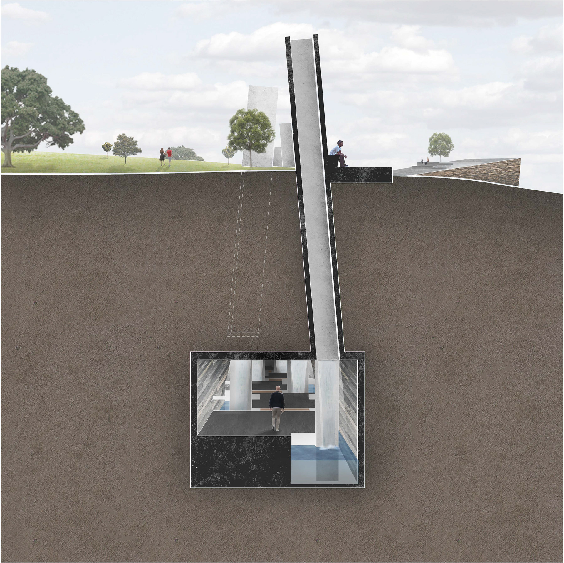
This museum’s spatial sequencing is derived from three distinct movements: submerge, traverse, and reveal. Visitors undertake the experience of the miner by journeying underground at the site of the original mine shaft. This delivers them to a compressive tunnel space which utilizes skylights and waterfalls as tools in narrating the history of the place, simulating the conditions of the disaster in a controlled, reflective manner. This story concludes when entering the main museum, where guests can explore various artifacts related to the mine and surrounding area. The skewed, cross-axial form of the building in plan makes direct reference to the overlapping, rotated grid system utilized through different layers of the salt mine.
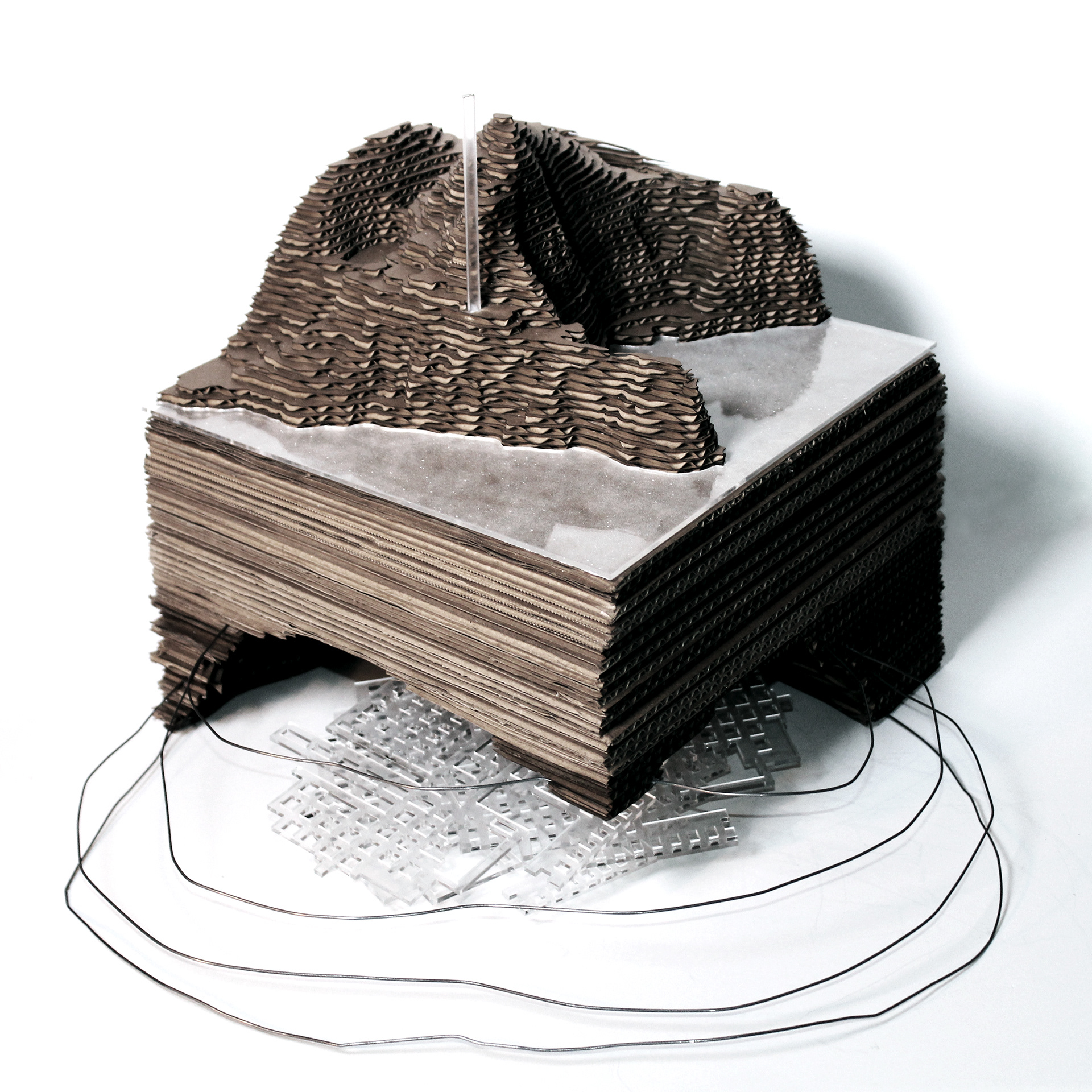
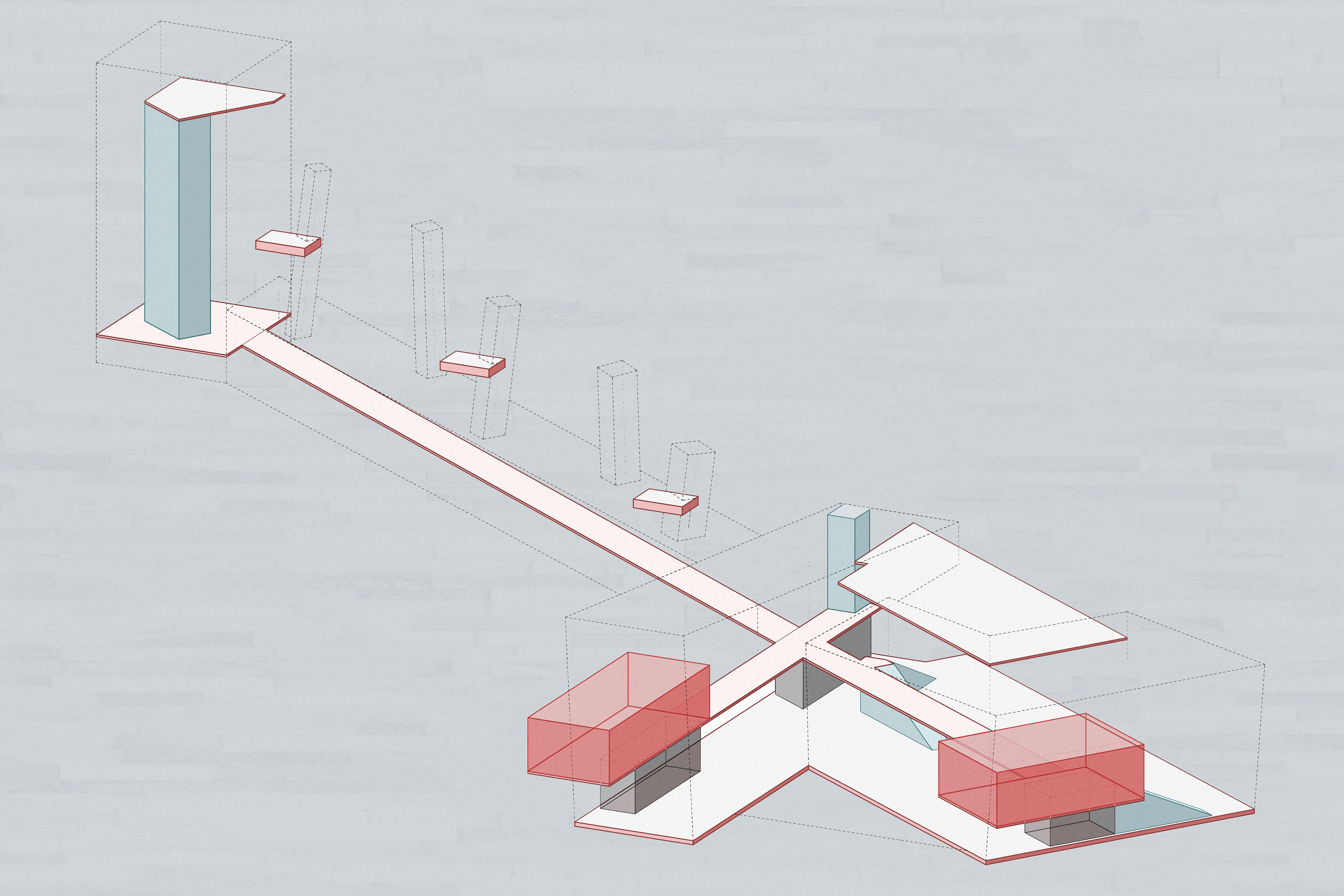
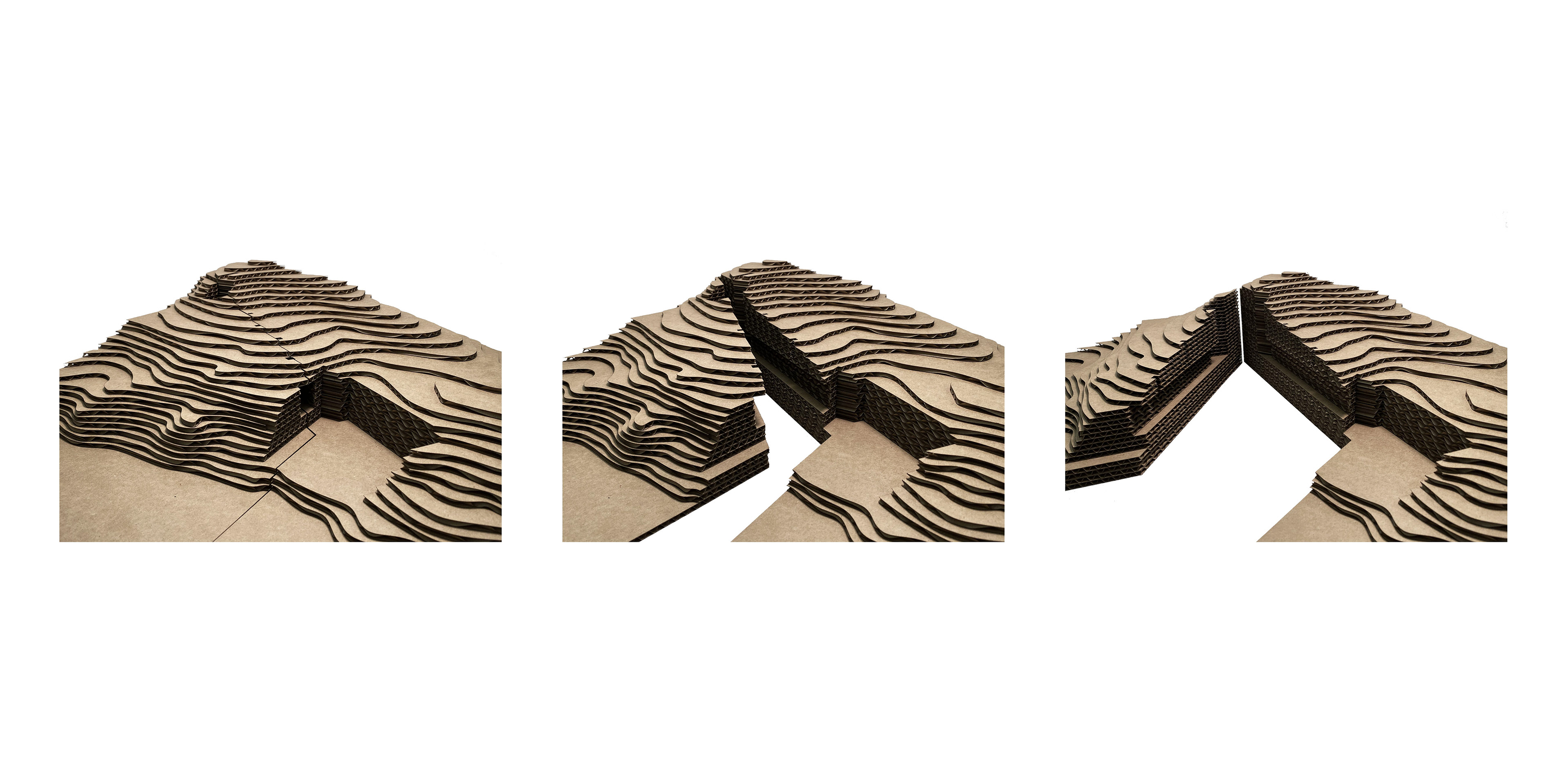
The project’s manipulation and reversal of the roles of positive and negative space stemmed from a similar concept seeded in the investigative site model below. This model exaggerates the Z axis, representing the salt dome beneath the peninsula as void and the tunnel system within that dome as solid. When translating this concept into built form, the floating elements of the massing appear solid, while the embedded program is voided from solid earth.